|
Figure 5 (A) Global fire zones, NASA. The Earth data fire map accumulates the locations of fires detected by moderate-resolution imaging radiometer (MODIS) on board the Terra and Aqua satellites over a 10-day period. Each colored dot indicates a location where MODIS detected at least one fire during the compositing period. Color ranges from red where the fire count is low to yellow where number of fires is large; (B) An ecological catastrophe in Russia: wildfires have created over 4 million square km smoke lid over central northern Asia. Big Siberian cities are covered with toxic haze that had already reached Urals. [from Aug. 13 post on the ever-lively and -provocative Arctic News website] 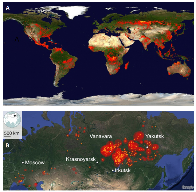
0 Comments
Your comment will be posted after it is approved.
Leave a Reply. |
Archives
June 2021
Kristin Prevallet Author/Editor
I'm a writer & teacher in Lawrence, Kansas who actually believes the scientists. I wrote a book of poems called Of Some Sky that seems to have something to do with all this. |
 RSS Feed
